

Case

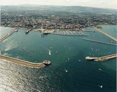
Urban high altitude lookout monitoring system
The high-altitude observation and long-distance video surveillance system is a complete set of video image acquisition equipment -- multi-sensor and multi-remote high-definition monitoring and cloud-top integration camera, which is composed of low-illumin
Details
Project overview
The high-altitude observation and long-distance video surveillance system is a complete set of video image acquisition equipment -- multi-sensor and multi-remote high-definition monitoring and cloud-top integration camera, which is composed of low-illumination and high-definition fog-penetrating digital camera with long-focal length fog-penetrating lens, heavy-duty and high-precision digital head and high-density protective cover. The monitoring point is built on the roof of the proposed site area. By using the feature of "climbing high and looking far" of the equipment, the vehicle in the monitoring area is monitored and managed, especially for the mud-head vehicle management, to prevent traffic accidents due to the loopholes of supervision.
Key points analysis
The construction position of the equipment must be selected as high as possible (not less than 20 meters). It is best to use the building near the site as the base point for the construction of the front-end camera equipment, and install the bracket on the roof. Because the top of the building is windy and installed at the same time, there are also unstable factors caused by shaking problems. Therefore, the wind resistance of the head and its own operation clearance control are the key to image stability. The high-altitude lookout system of Huaritong Technology Co., Ltd. covers a wide range of areas. At the same time, physical image stabilization technology and digital image processing technology are adopted. The image stabilization optimization processing chip is integrated in the head of the cloud head, and the video images collected by the camera are clearly optimized and processed, which strengthens the image stability in the high-altitude environment. In order to ensure the 24 hours and all weather work of the system, the ultra-low illumination camera is used to provide clear imaging monitoring in the environment of street lamps. The system uses high-definition fog transmittance camera and high-definition fog transmittance lens to achieve efficient fog transmittance performance, so that the equipment can achieve fog transmittance imaging monitoring in the weather environment such as haze and grey haze, and improve the monitoring effect of the system in bad weather environment. The perfect combination of high definition, fog penetration and low illumination achieves 24 hours uninterrupted video surveillance.
System composition
The fire aerial lookout video monitoring system consists of three parts: video acquisition system, transmission system, system power supply, storage and display management equipment of monitoring center.
The previous video acquisition system: multi-spectrum high-definition fog-penetrating camera, long focal length fog-penetrating lens, high precision digital head, high density protective cover, front control cabinet, lightning protection grounding, etc.
Transmission system: This system plans to adopt digital microwave wireless transmission mode.
System power supply: The power supply of the system adopts the principle of nearby power supply, using the low-voltage distribution box of the street lighting at the monitoring construction point to take power. In order to ensure the stability of the power supply of the system, the special line power supply mode is adopted, which is separated from the street lighting circuit (due to the time limit of street lighting, it cannot meet the 24-hour power supply); The monitoring camera or the relay transmission base station equipment constructed on the roof can obtain power from the building at the construction site, and also adopt independent power supply mode to ensure the stability of the power supply of the equipment.
Monitoring center management system: mainly display, storage, playback equipment, and monitoring center management software platform; As the command center of the whole high-altitude observation system, the video management software platform has several main functions: it is responsible for forwarding the collected and returned videos in the fire private network, real-time video storage, user rights management, equipment management, etc.
System workflow
In normal operation, the front-end acquisition equipment is equipped with multi-spectrum HD integrated gimbal camera. Make around-the-clock patrol to monitor the road and traffic conditions in the area, and send the collected video images to the monitoring center through the transmission system. The monitoring center is equipped with network monitoring platform, video storage system, etc. The collected video images are forwarded and stored, and the digital video stream is analyzed in real time. If mud trucks dump construction waste and muck, Or when illegal enterprises carelessly dump liquid waste, waste materials, waste residue, etc., which causes pollution and damage to the road surface, and the traffic condition is affected, or traffic accidents occur, video recordings can be accessed to investigate and collect evidence of the vehicles causing the accident and the illegal enterprises, and the law and regulations shall be dealt with, so as to strengthen road safety management.
Main characteristics of the system
All - round observation, surveillance and search of surrounding targets 24 hours a day
Manual search acquisition target, automatic tracking locked target and automatic fan scan monitoring target
High precision digital head and digital image stabilization technology can effectively isolate video shaking in high wind
Low illumination HD camera, to achieve the night light deficiency (street lighting environment) normal monitoring
Good resistance to carrier vibration and impact
Provides RS422/RS232 and 100M Ethernet interfaces
Video acquisition pointing device integral three-proof sealed nitrogen flush structure, conducive to a variety of bad environment long-term use
System function
Inspection warning:
The most important role of the high altitude observation system is to monitor the security situation of the city, find and respond in the first time; Through the cruise function of the high-altitude observation system, patrol and monitor the vehicles running on the road at the construction location. The personnel on duty can track and monitor in time according to the situation of the mud truck on the image, so as to prevent the mud truck from randomly dumping construction waste and muck on the road surface, causing traffic obstacles, traffic jams or accidents.
Verification of police situation:
The high-altitude observation system can be used to accurately verify citizens' reports of traffic conditions, road construction, or dumping of garbage and muck. Especially for some false alarm information, it can eliminate false alarm to a certain extent.
Rescue command:
Due to its high position, long monitoring distance and wide viewing Angle, when road traffic accidents or emergency rescue events occur, the remote monitoring features of the system equipment can be used to understand the dynamic traffic flow of nearby roads in advance, open up emergency rescue channels and deal with them in time.
Cooperation and cooperation:
In addition to urban safety management, the high-altitude lookout system can assist the public security, traffic police, environmental protection, urban management and other departments to timely detect and deal with the phenomenon of endangering social security, traffic hit-and-run, urban environmental pollution, illegal occupation and disorderly construction, and random dumping of construction waste.
Integrated scheduling:
While the high-altitude lookout system plays an important role independently, it can also be used in combination with various existing urban management systems to play a greater role, such as traffic police, municipal, public security, public security, urban management, etc.
Traffic command linkage:
Combined with the video surveillance system of the traffic police squadron, road monitoring system and other systems, it can monitor the specific situation of the police, the way, the arrival and the scene from the time of receiving the police. It plays a positive and important role in the timely dispatch of reinforcements, the request for the cooperation of relevant police and relevant departments, as well as the objective evaluation of rescue situation and scientific evaluation of rescue measures.
GIS accurate positioning:
By combining with urban GIS (geographic information system), the precise positioning function of target vehicles can be realized. Through the established digital coordinates of urban GIS, the orientation of target objects, target vehicles, accident site and so on can be accurately determined. If there are multiple high-altitude observation cameras, the position of a fixed point can be understood from an all-round perspective. By clicking a road or a junction on the map of the urban GIS system, the specific position of the point can be found in real time, as well as the running condition of vehicles, road traffic conditions and surrounding security conditions.