

Case
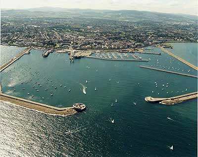
Maritime fisheries administration monitoring system
This system is designed for inland island, sea island, archipelago, uninhabited island, intrusion monitoring, island and its surrounding sea ecological environment needs, it integrates high performance imaging system and cloud head control system. The fro
Details
1. System definition:
This system is designed for inland island, sea island, archipelago, uninhbited island, intrusion monitoring, island and its surrounding sea ecological environment needs, it integrates high performance imaging system and cloud head control system. The front-end acquisition equipment of the system is installed in the fishing port or aquaculture area, and the optical cable or other communication lines are used for transmission. The video display equipment is installed in the island fishery monitoring center.
This system combines the high resolution fog-penetrating camera subsystem to observe, search, monitor and track the target. It can find, identify and confirm the target to be monitored and detected efficiently and timely. The system uses satellite positioning system, fishing vessel automatic identification system, geographic information system, computer network and data processing and other technologies to achieve real-time monitoring of Marine fishing vessels at sea and all-weather satellite communication between sea and land.
Government departments at all levels pay more and more attention to daily ship safety monitoring and rescue in distress. In order to prevent collision incidents of fishing boats at sea, improve the ability of fishing boats to deal with emergencies, grasp the dynamics of fishing ships on islands in real time, prevent typhoons and avoid disasters scientifically, and reduce casualties and property losses of fishermen, a fully-functional monitoring and command center on islands is built based on the actual situation of islands. Through the three-level video uploading monitoring, command and management platform, it provides efficient means and scientific and technological support for giving full play to the management function of the island monitoring and command center, which has become an urgent need for the modern management of the island.
2. Project Significance:
1) This system is to implement the Law of the People's Republic of China on the Protection of Islands, and is an important guarantee for realizing the national Marine development strategy; It is necessary to protect the ecological environment of the island and its surrounding sea area, and can effectively protect the ecological resources of the island. The need to effectively protect the legitimate interests of the right holder; It can promote the scientific and rational utilization of island resources and promote the sustainable development of island. The island security monitoring system can monitor the island, port, channel and surrounding conditions day and night, grasp the situation of ships and personnel entering and leaving the site in real time, and effectively prevent invasion, escape, smuggling, drug trafficking and other illegal acts;
2) For developed and used islands, this system can assist island development and management companies to achieve scientific and digital management of islands, strengthen the comprehensive management and personnel management of island development projects, and protect the sea area around the islands and the environment from pollution, so as to realize sustainable development. At the same time, scientific management is realized in the development and utilization of Marine resources and ancillary resources such as fishery, mariculture, island sightseeing and tourism, so as to maintain the sustainable development of the company.
3) After the implementation of the project, the monitoring and management of uninhbited islands can be strengthened to prevent other countries from stealing our islands and illegally exploiting resources near our islands, prevent pirates and criminals from escaping to uninabited islands, and prevent illegal exploitation of island resources and damage to island ecology.
3. Demand Background:
China has 6,536 islands with an area of more than 500 square meters, with a total area of more than 72,800 square kilometers and a coastline of 14,217.8 kilometers. There are 450 inabited islands. China has many small islands and few large ones, many unihabited islands and few inhbited islands, and many water-scarce islands and few water-rich ones. There are three large islands with an area of more than 1000 square kilometers. Taiwan, Hainan, Chongming Island. According to its origin can be divided into three categories: bedrock island, alluvial island, coral reef island. The East China Sea accounts for about 60 percent of the total number of islands, the South China Sea for about 30 percent, and the Yellow and Bohai Seas for about 10 percent. How to strengthen the protection of these islands, as well as the safety and protection measures of islands that have been developed for aquaculture and tourism, is the main measure of island management; A security "cordon" can be set up around some islands with special functions, and the system will automatically warn when intrusions, "transgressions" and theft occur.
System characteristics
System A is a national patented product with integrated structure design and stable operation. The system adopts advanced mechanical transmission technology, image anti-shaking physical image stabilization technology and computer image processing technology, and embedded image stability control software YCA-V1.0 and image detail enhancement processing software YCA-V1.1, which effectively prevents the impact of sea breeze on the video, and reduces the damage caused by strong wind to the front-end equipment. At the same time, stable and high quality video images can be obtained. Using high-end image sensor and intelligent image processing system, significantly improve product performance; The system combines a variety of active and passive optical sensors, which can effectively detect and capture the target in clear day or dark night. Advanced angular second level high precision head mechanism, improve the seismic/wind resistance performance, the image is stable and clear; Adopt standardized, modular design technology, good expansibility, easy maintenance; Adopt "three defense", sealing design technology, protection level IP66; Suitable for Marine/near water environment.
B Emergency handling work: Handling of typhoon prevention in fishery, emergency rescue of regional safety accidents in fishing ports, emergency command of fishery ship safety emergencies, emergency response of storm surge and tsunami disasters, emergency response of fishery water emergencies, investigation, treatment and disposal of Marine environmental pollution damage and accidents in fishery waters, emergency response of abnormal letters and visits, etc. To provide a platform for Marine Fisheries Command Office (Emergency Command Center) to carry out relevant work. The integrated program of GPS satellite positioning technology, GIS GIS technology, multi-system radio communication technology, computer network and data processing technology and other advanced and mature technologies can monitor, warn and accurately position island invasion behaviors through maritime satellites or high-frequency digital microwave systems. The image collected by the front-end video monitoring system can be transmitted to the land monitoring command center to strengthen the overall monitoring management.
Scope of application:
Uninhbited island monitoring, island breeding anti-theft and disaster prevention monitoring, island ecological environment protection monitoring, border island invasion prevention monitoring and early warning.