

Case

Ship navigation aid real-time monitoring system solution
This system is a technical scheme combining satellite network transmission, remote wireless video monitoring and ship local video monitoring. It aims to set up electronic video surveillance systems on maritime, maritime, maritime surveillance and border a
Details
overview
This system is a technical scheme combining satellite network transmission, remote wireless video monitoring and ship local video monitoring. It aims to set up electronic video surveillance systems on maritime, maritime, maritime surveillance and border and coastal defense law enforcement vessels, form joint surveillance forces with satellite aerial remote sensing surveillance and ground surveillance, and carry out all-weather, three-dimensional and 24-hour continuous remote day and night monitoring of the sea area, so as to accurately grasp first-hand information on the use of the sea area, Marine environment and Marine disasters. Based on the Marine law enforcement system, an information service platform for Marine law enforcement has been established to release information on the use and management of sea areas to the public and sea-related departments, and provide technical support for early warning and prediction of Marine disasters, anti-piracy, maritime smuggling, illegal sand mining and other illegal emergency decisions.
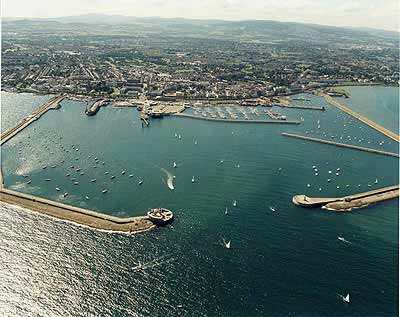
The ship navigation aid system is designed to track and monitor the state of the sea area, the law enforcement situation on the sea surface, the state of the sea channel, the islands, reefs and sand in the sea area within 20 kilometers around the law enforcement ship, and can automatically track and monitor the target object entering the field of view by combining the navigation and positioning system equipment such as maritime radar and gyrocompass. The system integrates a variety of high-performance imaging systems and precision servo control systems, using active and passive optical imaging performance, gyro stability structure, automatic tracking terminal platform, overcome the characteristics of the sea environment and the defects of light absorption of seawater, the target object can be efficiently observed, searched, monitored and tracked.
System characteristics
This scheme adopts advanced gyroscopic stabilization technology and computer image processing and control technology, which can effectively prevent the swaying of the camera system caused by the sea wind. The system can flexibly select various specifications of optical lens, camera and infrared thermal imager according to user's requirements. The system has the following characteristics:
1. Adopt high-end image sensor and intelligent image processing module to significantly improve product performance
2, can be combined with a variety of active and passive optical sensors, whether in a clear day, dark night, poor visibility fog days, can effectively discover and capture the target
3, using advanced intelligent image processing technology, automatic target tracking technology, the image is stable and clear
4, Adopt standardized, modular design technology, good expansibility, easy maintenance
5, the use of "three prevention", sealing design technology, conducive to harsh environment long-term use
6. Advanced gyro-servo stabilization technology is adopted to effectively isolate the swaying caused by strong winds
7, all Chinese control interface, inuitive and convenient operation
Systematic significance:
Water traffic safety management functions: sea area management, Marine law enforcement, Marine disaster warning, ship navigation management, ship monitoring of coastal/port and other surrounding conditions, water salvage rescue, emergency rescue decision-making and other technical support
Fog navigation and night vision function: through the installation on the bow deck of the ship to the direction of the sea within 20 kilometers of the situation on the deck to do real-time monitoring
Anti-collision warning function: reduce the collision event in the bad environment such as rain and fog weather and night navigation, and ship collision event in the near bridge area
Video forensics function: real-time monitoring and management of jurisdictional sea areas. After completion of the system, it will effectively crack down on smuggling, smuggling, illegal occupation of Marine resources and illegal development of ecological islands, and provide effective guarantee for the protection of Marine resources in the South China Sea
System composition:
The system consists of ship monitoring system, satellite transmission system and land monitoring center management system. Ship management monitoring system includes: integrated day and night imaging photoelectric tracking monitoring camera (visible light remote camera system, far infrared thermal imaging camera system, laser assisted lighting system), ship control management display console, photoelectric tracking software platform); The satellite transmission system includes: satellite signal transmission and control equipment. After the signal is on the satellite, a receiving system is built on the land or a land receiving base station is used by maritime satellite. After the video data is landed, it is transmitted to the land command center of Oceanic Administration by special network. The monitoring management center mainly includes: large screen display equipment, video image management server, hard disk recorder storage and other devices.
Main function
The main functions of the ship's navigation aid system are as follows:
1. Through the high-precision navigation aid monitoring equipment installed on the ship's roof, 24-hour imaging can be used to monitor the sea conditions around the ship in real time
2. The terminal control system shall be built in the cockpit of the ship. The terminal platform shall realize the automatic tracking of objects around the ship after linkage with radar and gyrocompass with intelligent tracking and monitoring software
3. The system transmits front-end video signals and data signals back to the land command center through the satellite transmission system equipment, providing reference for the command and decision of emergencies
4. Record the surrounding video image data in real time to provide rich data for the post-occurrence of the scene situation
Sea area monitoring
24-hour real-time monitoring of coastal waters, tracking and monitoring of passing ships, effectively crack down on smuggling, smuggling and other illegal acts, and when there is a ship distress signal in the law enforcement area, video confirmation, and give necessary help.
Ship management:
The ship's local video monitoring management, land video monitoring management and remote dispatch and command in case of emergencies are realized to reduce property losses and guarantee life safety, and to provide strong support and guarantee for water traffic safety.
Rescue at sea:
In case of maritime accidents or emergencies, assist salvage vessels at sea in timely rescue and rescue, and realize the timely control, dispatching and command of the land emergency command center on the scene of emergencies; Ensure timely and efficient rescue.
In addition to the above functions, it has the following functions:
1. Day and night imaging function
2. The color mode of visible light imaging system is very suitable for observation, monitoring and recognition under clear weather and good visibility; Black and white mode has higher video resolution and low illumination imaging ability. At the same time, the function of far infrared thermal imaging is not interfered by environmental factors to realize large-area search and monitoring in foggy days and nights, and then assisted by laser lighting system to realize detailed observation and monitoring of the targets searched by thermal imaging. The efficient combination of the three realizes the real sense of 24 hours of uninterrupted imaging monitoring function.
3. With the function of manual search, capture and automatic tracking of the target
4. The system is very convenient to operate. It can search, observe and monitor the target in the air at different speeds by manually manipulating the single rod, and automatically track the target that needs to be monitored.
5. Good visual axis stabilization function
6. The photoelectric pointer adopts spherical structure, which has the advantages of small wind resistance and strong wind resistance; The gyro stabilization system can effectively isolate the swing of the installation platform caused by strong wind, so as to maintain the stability of the photoelectric camera system, get clear and stable images, and ensure that the target image is always on the TV screen without losing.
7. With target manual and automatic tracking functions
8. Adopt advanced image processing and recognition technology, target automatic tracking technology, so that the target required to track is kept in the center of the TV field of view.
9. With radar guidance and tracking function
10. By connecting the guidance signal of the radar system, the linkage between radar and photoelectric can be realized, giving full play to the advantages of the long range of radar and the visual imaging of the photoelectric system to capture the target in time.
11. It can adjust the optical parameters such as electric multiplier and focusing.
12. Three prevention treatment is adopted, and the pointing device is sealed and filled with nitrogen, which is conducive to long-term use in outdoor environment.
13. With capture picture, real-time hard disk video function;
This system is a technical scheme combining satellite network transmission, remote wireless video monitoring and ship local video monitoring. It aims to set up electronic video surveillance systems on maritime, maritime, maritime surveillance and border and coastal defense law enforcement vessels, form joint surveillance forces with satellite aerial remote sensing surveillance and ground surveillance, and carry out all-weather, three-dimensional and 24-hour continuous remote day and night monitoring of the sea area, so as to accurately grasp first-hand information on the use of the sea area, Marine environment and Marine disasters. Based on the Marine law enforcement system, an information service platform for Marine law enforcement has been established to release information on the use and management of sea areas to the public and sea-related departments, and provide technical support for early warning and prediction of Marine disasters, anti-piracy, maritime smuggling, illegal sand mining and other illegal emergency decisions.
The ship navigation aid system is designed to track and monitor the state of the sea area, the law enforcement situation on the sea surface, the state of the sea channel, the islands, reefs and sand in the sea area within 20 kilometers around the law enforcement ship, and can automatically track and monitor the target object entering the field of view by combining the navigation and positioning system equipment such as maritime radar and gyrocompass. The system integrates a variety of high-performance imaging systems and precision servo control systems, using active and passive optical imaging performance, gyro stability structure, automatic tracking terminal platform, overcome the characteristics of the sea environment and the defects of light absorption of seawater, the target object can be efficiently observed, searched, monitored and tracked.
System characteristics
This scheme adopts advanced gyroscopic stabilization technology and computer image processing and control technology, which can effectively prevent the swaying of the camera system caused by the sea wind. The system can flexibly select various specifications of optical lens, camera and infrared thermal imager according to user's requirements. The system has the following characteristics:
1. Adopt high-end image sensor and intelligent image processing module to significantly improve product performance
2, can be combined with a variety of active and passive optical sensors, whether in a clear day, dark night, poor visibility fog days, can effectively discover and capture the target
3, using advanced intelligent image processing technology, automatic target tracking technology, the image is stable and clear
4, Adopt standardized, modular design technology, good expansibility, easy maintenance
5, the use of "three prevention", sealing design technology, conducive to harsh environment long-term use
6. Advanced gyro-servo stabilization technology is adopted to effectively isolate the swaying caused by strong winds
7, all Chinese control interface, inuitive and convenient operation
Systematic significance:
Water traffic safety management functions: sea area management, Marine law enforcement, Marine disaster warning, ship navigation management, ship monitoring of coastal/port and other surrounding conditions, water salvage rescue, emergency rescue decision-making and other technical support
Fog navigation and night vision function: through the installation on the bow deck of the ship to the direction of the sea within 20 kilometers of the situation on the deck to do real-time monitoring
Anti-collision warning function: reduce the collision event in the bad environment such as rain and fog weather and night navigation, and ship collision event in the near bridge area
Video forensics function: real-time monitoring and management of jurisdictional sea areas. After completion of the system, it will effectively crack down on smuggling, smuggling, illegal occupation of Marine resources and illegal development of ecological islands, and provide effective guarantee for the protection of Marine resources in the South China Sea
System composition:
The system consists of ship monitoring system, satellite transmission system and land monitoring center management system. Ship management monitoring system includes: integrated day and night imaging photoelectric tracking monitoring camera (visible light remote camera system, far infrared thermal imaging camera system, laser assisted lighting system), ship control management display console, photoelectric tracking software platform); The satellite transmission system includes: satellite signal transmission and control equipment. After the signal is on the satellite, a receiving system is built on the land or a land receiving base station is used by maritime satellite. After the video data is landed, it is transmitted to the land command center of Oceanic Administration by special network. The monitoring management center mainly includes: large screen display equipment, video image management server, hard disk recorder storage and other devices.
Main function
The main functions of the ship's navigation aid system are as follows:
1. Through the high-precision navigation aid monitoring equipment installed on the ship's roof, 24-hour imaging can be used to monitor the sea conditions around the ship in real time
2. The terminal control system shall be built in the cockpit of the ship. The terminal platform shall realize the automatic tracking of objects around the ship after linkage with radar and gyrocompass with intelligent tracking and monitoring software
3. The system transmits front-end video signals and data signals back to the land command center through the satellite transmission system equipment, providing reference for the command and decision of emergencies
4. Record the surrounding video image data in real time to provide rich data for the post-occurrence of the scene situation
Sea area monitoring
24-hour real-time monitoring of coastal waters, tracking and monitoring of passing ships, effectively crack down on smuggling, smuggling and other illegal acts, and when there is a ship distress signal in the law enforcement area, video confirmation, and give necessary help.
Ship management:
The ship's local video monitoring management, land video monitoring management and remote dispatch and command in case of emergencies are realized to reduce property losses and guarantee life safety, and to provide strong support and guarantee for water traffic safety.
Rescue at sea:
In case of maritime accidents or emergencies, assist salvage vessels at sea in timely rescue and rescue, and realize the timely control, dispatching and command of the land emergency command center on the scene of emergencies; Ensure timely and efficient rescue.
In addition to the above functions, it has the following functions:
1. Day and night imaging function
2. The color mode of visible light imaging system is very suitable for observation, monitoring and recognition under clear weather and good visibility; Black and white mode has higher video resolution and low illumination imaging ability. At the same time, the function of far infrared thermal imaging is not interfered by environmental factors to realize large-area search and monitoring in foggy days and nights, and then assisted by laser lighting system to realize detailed observation and monitoring of the targets searched by thermal imaging. The efficient combination of the three realizes the real sense of 24 hours of uninterrupted imaging monitoring function.
3. With the function of manual search, capture and automatic tracking of the target
4. The system is very convenient to operate. It can search, observe and monitor the target in the air at different speeds by manually manipulating the single rod, and automatically track the target that needs to be monitored.
5. Good visual axis stabilization function
6. The photoelectric pointer adopts spherical structure, which has the advantages of small wind resistance and strong wind resistance; The gyro stabilization system can effectively isolate the swing of the installation platform caused by strong wind, so as to maintain the stability of the photoelectric camera system, get clear and stable images, and ensure that the target image is always on the TV screen without losing.
7. With target manual and automatic tracking functions
8. Adopt advanced image processing and recognition technology, target automatic tracking technology, so that the target required to track is kept in the center of the TV field of view.
9. With radar guidance and tracking function
10. By connecting the guidance signal of the radar system, the linkage between radar and photoelectric can be realized, giving full play to the advantages of the long range of radar and the visual imaging of the photoelectric system to capture the target in time.
11. It can adjust the optical parameters such as electric multiplier and focusing.
12. Three prevention treatment is adopted, and the pointing device is sealed and filled with nitrogen, which is conducive to long-term use in outdoor environment.
13. With capture picture, real-time hard disk video function;